12d Synergy’s mapping can be configured to overlay many GIS types and open-source data layers, which include any of the following categories.
ArcGIS Server
ArcGIS Online Base Map
WMTS
Shape Files
KML / KMZ
For details about adding and configuring map layers, please read the 12d Synergy knowledge base here.
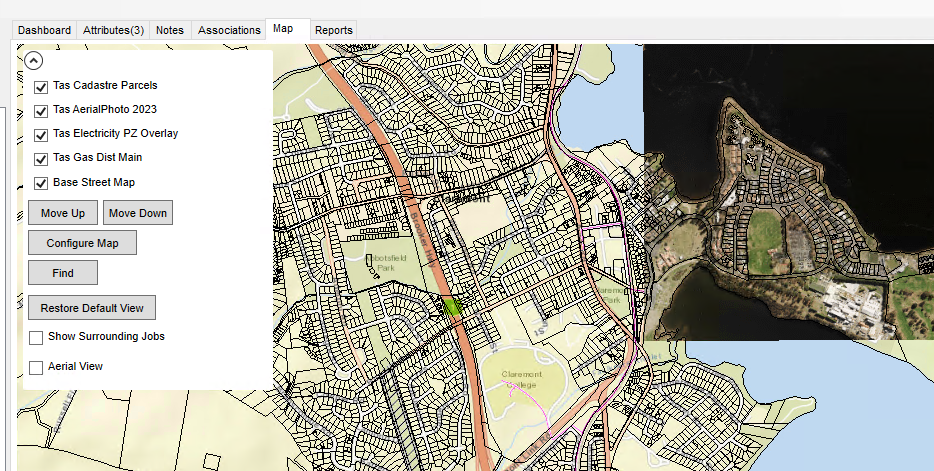
Open Source Data - Tasmania
Open source data is available throughout Australia, New Zealand and the world.
Listed below are some of the open source data that can be utilised within 12d Synergy and 12d Model.
https://www.dcceew.gov.au/environment/environmental-information-data/web-services
https://data.stategrowth.tas.gov.au/ags/rest/services/PROJECTS/Gas_Dist_Main/MapServer
https://data.stategrowth.tas.gov.au/ags/rest/services/PROJECTS/Electricity_PZ_Overlay/MapServer
https://services.thelist.tas.gov.au/arcgis/rest/services/Public/CadastreParcels/MapServer
https://services.thelist.tas.gov.au/arcgis/rest/services/Basemaps/AerialPhoto2023/MapServer
https://services.thelist.tas.gov.au/arcgis/rest/services/Basemaps/Tasmap25K/MapServer
For more details about Mapping Layers, please access the 12d Synergy Knowledge Base.