Geocoding is the process of converting addresses (like a street address) into geographic coordinates (latitude and longitude), which you can use to place markers on a map, or position the map. Addresses are automatically geocoded into latitudinal and longitudinal coordinates using a geocoder provided by ESRI and ArcGIS Online.
When you enter the value for an address attribute of an entity (example: Job address attribute, Folder address attribute, etc.), 12d Synergy attempts to geocode it. If the address is not traceable, 12d Synergy will inform you that it was unable to find a match for the given address.
1.1. How to Set Up Geocoding
12d Synergy by default provides a geocoding service that utilises ESRI's ArcGIS Online. If you have your own ArcGIS geocoding service, you can use that instead.
- In the 12d Synergy Administration application, select the Mapping tab > Geocoding Configuration tab.
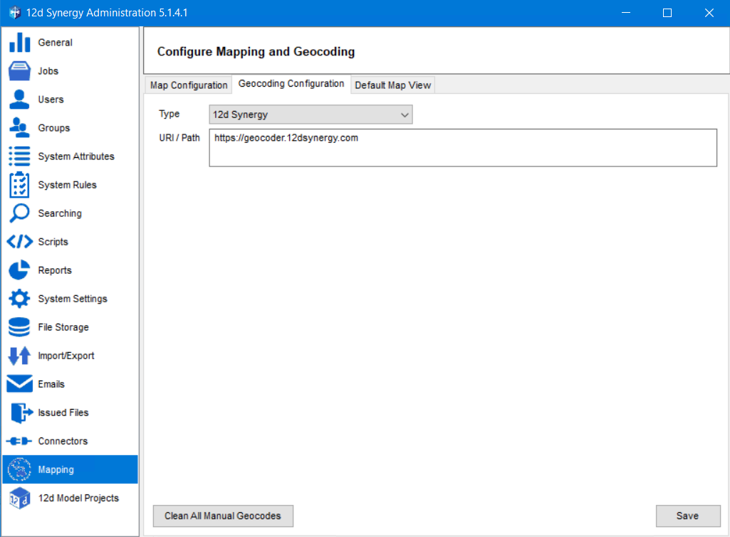
By default, the 12d Synergy option is selected from the Type list. The path to the default geocoder is also displayed in the URL/Path box. - Select the ArcGIS Server from the Type list.
The settings displayed are based on the option you select from the Type list.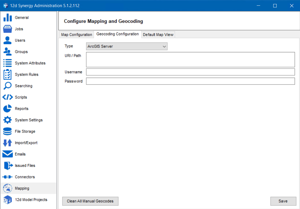
- Enter the details displayed in their corresponding boxes as provided by your ArcGIS Server Administrator.
- Click the Save button.
The selected geocoding service is set.